
 ع
ع



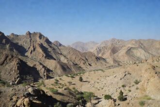
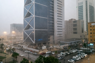
The National Center for Meteorology has forecast thunderstorms accompanied by hail, gusty conditions and dust-stirring winds across western parts of the Kingdom. These conditions are expected to affect the regions of Jazan, Asir, Al-Baha, Najran and Makkah, where dust-lifting winds will lead to near-zero horizontal visibility along the coastal road to Jazan and in the eastern parts of Najran. The center’s bulletin highlighted active winds as a common feature in the affected zones, forming part of a broader summer weather pattern that has persisted in recent weeks.
City-specific projections from the National Center for Meteorology place Makkah and Dammam at the highest temperatures of 45 degrees Celsius, while Riyadh is expected to reach 43 degrees Celsius with active winds. Abha is forecast to be the coolest major city at 29 degrees Celsius, accompanied by thunderstorms and active winds, as Jazan faces a similar mix of thunderstorms, active winds and raised dust. These temperature extremes underscore the varied impacts across different parts of the country on July 26.
Maritime details released by the National Center for Meteorology indicate northwesterly to westerly winds of 12 to 35 kilometers per hour over the northern and central Red Sea, shifting to westerly to southwesterly at 15 to 50 kilometers per hour in the south. Wave heights in those waters are projected between 0.5 meters and more than 2 meters, producing sea states that range from calm to choppy. In the Arabian Gulf, the center anticipates northwesterly to westerly winds of 15 to 35 kilometers per hour in the north, with northeasterly to easterly flows shifting northerly at 10 to 25 kilometers per hour in central and southern sectors, where waves reach 0.5 to 1.5 meters and seas remain relatively calm.
The National Center for Meteorology recorded Saudi Arabia’s lowest dust and sandstorm activity in more than 25 years during June 2026, with events dropping by 99 percent from prior periods. The latest forecast of renewed dust-stirring winds signals a return to more typical arid-zone patterns amid ongoing high temperatures. Such shifts have historically influenced air quality and prompted monitoring by regional authorities.
Continued thunderstorm activity through July 26 has been tracked by the National Center for Meteorology using projections from the Saudi Numerical Model. Comparable alerts issued earlier in the month for overlapping western regions noted risks of heavy rainfall and hail, consistent with patterns seen in prior summer forecasts. The center has stopped short of new specific warnings in its latest update but maintains regular assessments for affected populations.
The National Center for Meteorology’s comprehensive outlook combines land and sea predictions to support preparedness across sectors including transportation and maritime operations. Dust events, while reduced overall in recent data, remain a focal point for the authority’s 72-hour forecasts covering Saudi Arabia and the wider Arabian Peninsula. Updates from the center continue to inform public responses as conditions develop throughout the day.